I woke up to a downpour of rain on the tent today. It was just the sound I was hoping to hear. It's not that I didn't want to go out on traverse today, but it's nice to have an office day every once in a while. Plus, traversing in the rain yesterday and not finding any proper outcrop was a bit of a bummer. Speaking of which... When my trav partner plotted our traverse on the map, it turns out that little bit of possible-outcrop-from-underneath-the-tree was actually off the map we're doing. Not by much, but enough that we did truly get skunked yesterday.
So the office day today has been mostly busy. I spent the morning cleaning the shotgun and handgun (shotgun for fly camp, and my boss carries the handgun in the bush instead of bear spray). The shotgun doesn't have a waterproof case, so it's looking a bit rusty, so I had to put some elbow grease into it. I know it sounds weird, but I really enjoyed that. It's kinda fun to take them apart and oil them up while listening to music. It's soothing. After lunch, I was slabbing some rocks when the rock saw ran out of gas. After refilling the fuel tank, the saw wouldn't spin anymore even though the engine was going. I busted out the manual, took some covers off and found the problem: the fly belt was shredded to pieces. It's going to take a while to get a new belt up here, so that sucks. The North is pretty isolated. The closest decent sized city (Smithers) is an 8-hour drive away, and the closest proper city (Prince George) is even further than that. We had to order new tires for the truck (as we kept getting flat tires) and it's been 2 weeks, and we still don't have them. Imagine if that was our only vehicle, we'd be SOL. This belt has to be ordered from Vancouver, so it probably won't even be up here by the time we're done. Basically things are shipped up here through a freight company that leaves Smithers every Monday morning, and it arrives up here on Wednesday morning. The truck is packed Sunday night, so if something isn't in Smithers by Sunday, we're not getting it for a week. Even groceries are ordered like this, so living up here requires one to plan ahead by about a week. There is a store in Dease Lake, but it doesn't really have a lot of food, just kind of the basic things you'd need, like a bigger corner store. It's about the size of a 7-Eleven. So that's also why our shower probably won't get fixed by the time we leave. It's kind of like an entirely different way of life up here. Life's slower up here, and you just have to adjust to it.
My boots have finally dried out since fly camp. While this is lovely for my feet, it really accentuates how trashed my boots are. They look like they've got a few hundred kilometers on them, which I bet they do at this point. We hike about 5-10km every day, so that's about....150km at the least. Not bad for a month, not bad at all. We've got about another month up here still, but only about 10 traverses or so. We're running out of chopper time, and also out of map area that's accesssable. That's really the main problem: Accessibility. You'd think that with a chopper we could just set down anywhere, and hike around and find rock, but unfortunately the rock here is pretty elusive. There's a fair amount of swamp and other low lying areas where there is no exposure, and plenty of bush cover everywhere else. We had a couple good traverses in the alpine above the treeline, but there really wasn't too much of that. Just enough to realize how crappy the bush is, and how lovely it is to hike in the alpine, even with the rain and snow and wind.
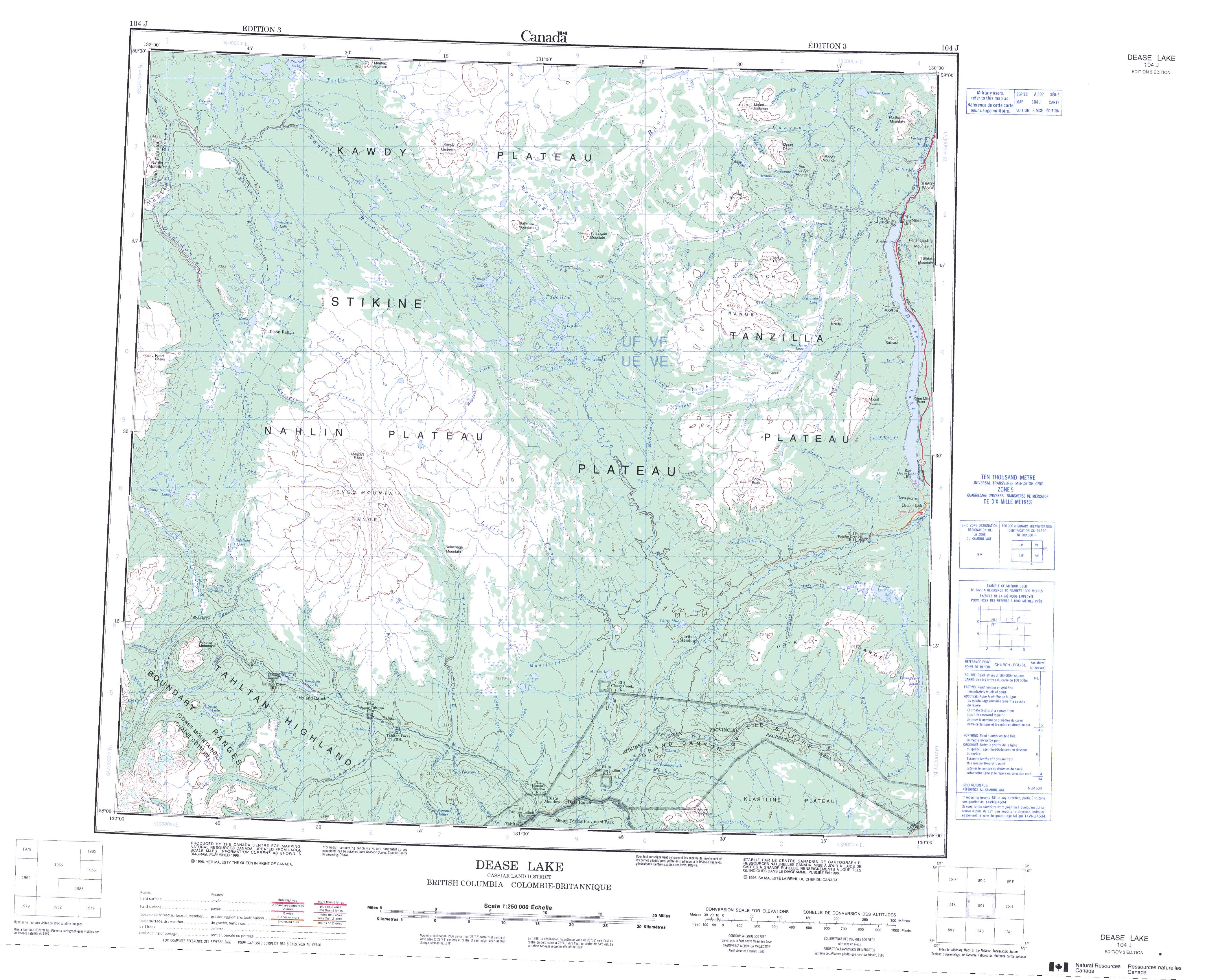
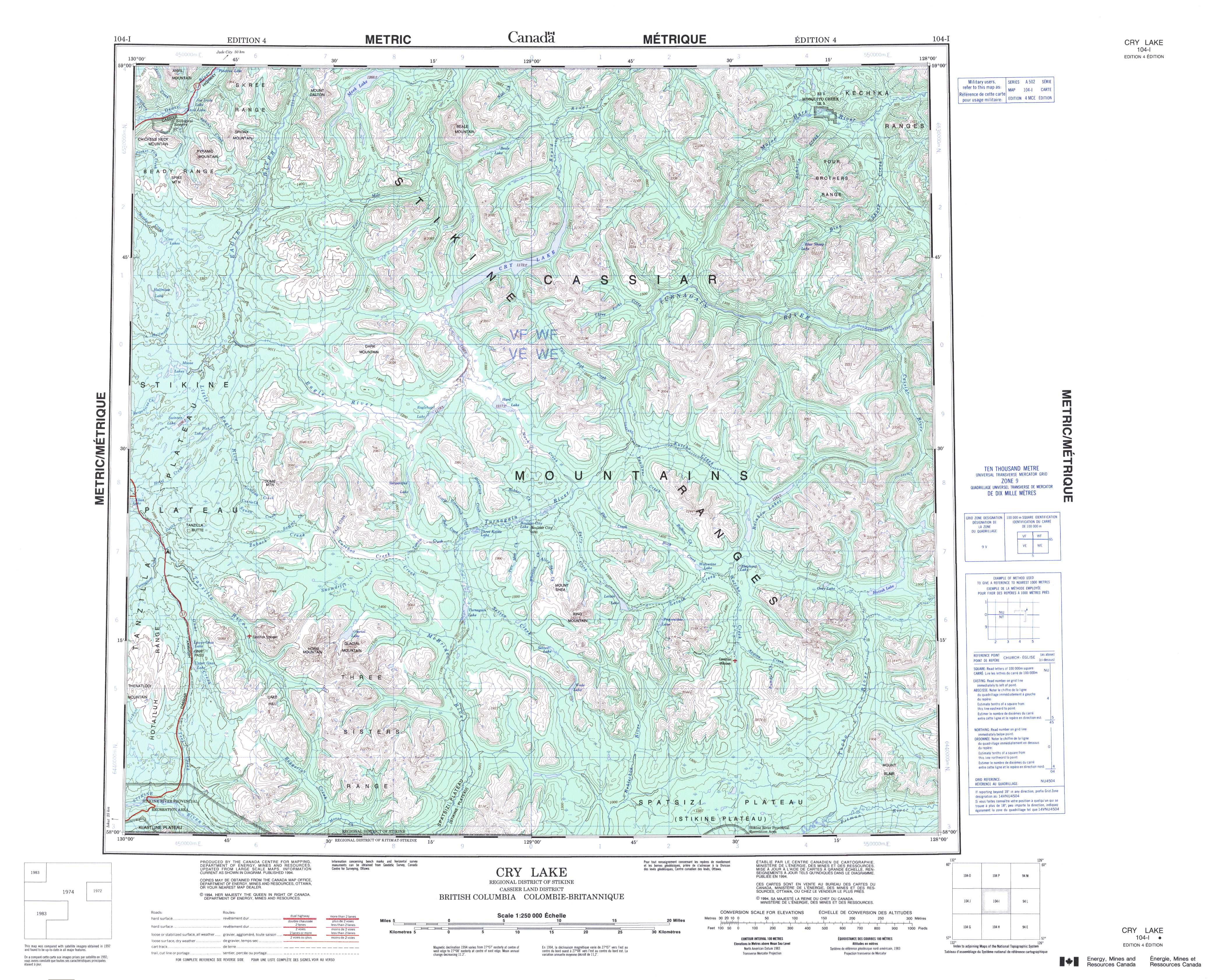
I know Ron was wondering about possibility of geology overlays for GoogleMaps and GoogleEarth, but unfortunately there aren't any dedicated geological ones (The BCGS has some here but they look pretty basic (Disclaimer: I can't run GoogleEarth and double check this, so reviews are 100% welcome)). The current geological map (NTS Maps 104J and 104I) or the topographical map we're using (104J and 104I) can be found at those places. Both geological maps are in black-and-white, and difficult to read (as they're coded instead of coloured). I spent a while today looking for a coloured map to no avail (which is a bummer, because we have copies here on the wall). I hope we will be using our data from this summer to create a KML file for GoogleEarth, because that would be awesome.
Edit: The maps won't load on my laptop here (slow connection and all) but this page from Geoscience BC appears to have geology maps of BC.
Sunday, July 31, 2011
Saturday, July 30, 2011
Mosscrop
 |
| Our note to whoever's driveway we parked in. |
We got skunked today. Not by a skunk, but by the geology. We hiked 10km through the bush, along lakeshore, up a creek, around another lake, up two knobs, and then back down a creek...no outcrop all day. Just mosscrop.
 |
| Looking northwest from the east side of Dease Lake |
Okay, it wasn't THAT bad. But it wasn't good. We hiked along Dease Lake for the first four kilometers of our traverse, sneaking up into the bush when the lakeshore disappeared. We watched some floatplanes land and takeoff, and it was hardly raining at this point (as you can see from the picture).
 |
| A nice photo of the mosscrop |
 |
| Handlens closeup of some moss |
We finished early, after adding on a few extra bits that were just off the map area. We found this overturned tree around 2:30pm that had some rocks underneath it, so we had some subcrop.We couldn't really tell if it was in situ or not, but these rocks were definitely bedded. It would have been epic if we had bedding, but we couldn't really tell. It was kinda sketchy as it was, but we had to do something geology-related today to earn our keep.
Unfortunately our slog back to the highway was swampy. Over-the-top-of-my-boot swampy. My socks are soaked, my boots are soaked...Just not good. I was already soaked anyways (thanks to the rain) so it wasn't such a big deal. At least it's sunny out now, and my boots are drying by the firepit.
Unfortunately our slog back to the highway was swampy. Over-the-top-of-my-boot swampy. My socks are soaked, my boots are soaked...Just not good. I was already soaked anyways (thanks to the rain) so it wasn't such a big deal. At least it's sunny out now, and my boots are drying by the firepit.
Friday, July 29, 2011
Putting my faith in foliage.
Today was the most beautiful weather we've had in weeks up here. Blue sky in the morning, sunshine....Wow. I keep forgetting what summer is supposed to be like. It was a great day for a traverse.
We started off up on this knob in the forest, hiked down into a creek, hiked around in the creek searching for this limestone for a few hours, and then hiked back up the other side, and then hiked along a ridge until we got to the swamp for our pickup. The hiking-down part was pretty good; the bush wasn't thick, and we had some outcrop. The creek was pretty dense with brush. It had a pretty good flow to it, even pretty deep in some parts. We had a bit of trouble finding somewhere to cross, but we found a bit of a logjam to cross eventually. The creek was pretty cliffy on both sides, and we had to do a bit of depending on foliage to get around. We had to kinda Tarzan off of this cliffy part using a tree branch, but the branch was covered in dry pine needles, which mostly ended up in my hair and down my shirt. Pretty awesome. There was a ledge I had to inch over, grasping onto juniper branches (I was wearing gloves) to prevent myself from ending up in the creek. The edge of my boots barely fit on the ledge...It was a bit of a tight maneuver. We spent a few hours hanging out around the creek, searching for this limestone that was apparently there. I guess the team that mapped this area back in like the '80's did it all from a helicopter, and granted, these rocks certainly look like limestone. However, they just have a calcite cement on the surface, and when you whack them open with your hammer (or with your trav partner's sledge), you can clearly see that they are not limestone, but a flow-top-brecciated type of rock (lots of amygdoloidal basalt (with zeolites) and clast-y bits). So, we did make some changes to the map (which is what our main goal this summer is), but it was a bit of a pain to bum around in the creek all morning...especially this afternoon.
We had a late lunch by the creek, and then hiked up the ridge again. Unfortunately the bush was a lot thicker on this side of the creek. It was a bit brutal. My thighs and hips are killing me from having to kangaroo-step over all the bush all afternoon. We ended up taking a bit longer to get up the hill than expected, and it was a bit further than we thought to get to our pickup spot. We scaled the ridge by about 3:30pm, and then we had another 3km or so to get to the swamp/pickup spot. I have never bushwacked so fast in my life. It's too thick to run, but we definitely hoofed it. We knew it was going to be close, but we really had no other options. So we booked it. And still did geology. At 5pm, at the last geology stop, we had just over another kilometer to go to the swamp, with a half-hour till pickup. The bush for that last half hour was probably some of the worst bush I've been in up here, and that's saying something. The shrubs were about 8 feet high, and dense enough that I lost my trav partner a couple times (He's taller than me, has longer legs, and can walk over logs and shrubs that I have to yoga over). We did make it to the swamp with about 2 minutes to spare. I'm so tired now. I have to stretch out my legs tonight for sure, otherwise tomorrow morning will be brutal.
Speaking of brutal, our shower broke about 6 days ago, and it's not fixed yet. It's an electrical problem with the pump inside the on-demand-heater, so it's pretty much beyond repair, but I think we're getting another one sent up here, but that will take about a week or two. It's pretty isolated up here. A couple people have lucked out and had brief showers inside the house, but because the hot water tank is not working properly, we have to have super short showers, and only two people a day. I haven't showered in 6 days, and I don't even really mind anymore. I'm sure I smell bad, but I can't smell myself (like I could after fly camp) so I'm sure it's not that bad. That, and we're all in the same boat, alternating showers. Today was a rough day to have no shower, as I have a riduclous amount of nature in my hair. I'll have to shake myself off before I crawl into my sleeping bag tonight.
Thursday, July 28, 2011
Knob-hopping...
Yesterday was my first day back in the real bushy terrain since fly camp. Our drop off spot was in a swamp (pretty typical for around here), but it was a nice swamp, as far as swamps go.

 |
| The good swamp. |
We've got a new pilot (Roben is on his 10 days off) and I don't think he really gets us. Yesterday for example: He was kind enough to try to land as far on the side of the swamp as possible, which was great, but I mean, we had to hike across about 3 or 4 swamps that day anyway (including the swamp we landed in) so it's not like my boots were gonna stay dry anyways. That swamp was mostly dry anyways, but the brush he landed in got caught in the door when I was trying to close it, so I had to manhandle the brush to close the door, and then had the same issue with the cargo door. The chopper has low skid gear (which is not ideal, considering what we're landing in), and I don't think he really gets why we thrash around in the bush all day. Especially on days like yesterday.
 |
| Snails getting in the way of the geology (through my handlens) |
The bush was pretty thick that day. I couldn't see my trav partner about 10 feet in front of me. It was mostly spruce (horizontal spruce) but not a lot of buckbrush(thank goodness). We had pretty long traverse, about six kilometers, all through 100m knobs and swamps. "Knob-hopping" as my trav partner called it. It was actually not a bad day (all Stuhini pyroxene-porphyry and some fragmental/conglomerate-type rocks) until about 4:30 when the wind and rain started. Apparently there's this epic storm blowing in. We found out the hard way. In less than a half-hour I went from dry and geologizing to soaking wet hiding in a grove of trees waiting for the helicopter. I couldn't even be lured out by a beautiful bedded sandstone. The wind was so strong it was blowing the contacts around on my eyeballs. So needless to say, I don't really know what our pilot thinks of us, swimming through swamps and bush all day, getting picked up soaking wet.
 |
| Biggest Cariboo Ever. |
I did see the biggest cariboo I've seen yet though. It was HUGE. We were hiking down into a swampy-creek area, and this cariboo just stopped and stared as us. We put up our arms like antlers, and he started walking towards us... his antlers were just ridiculous. When we were getting picked up, we saw another huge one. Pretty neat.

Bruise-Watch 2011: It's black now. I think it's probably the best bruise of the summer. It's only gonna get better too....
Tuesday, July 26, 2011
Some hot chocolate with my marshmallows.
I've been playing around with Google Maps, and figured out how to plot all my traverses and fly camps so that everyone can see where I've been! I'm going to be updating it more, and hopefully putting dates on all those traverses, because some of them are from a while ago. I bet on one of my days off I'll just bang them all out.
It's been a good couple of days back in camp though. Yesterday, I went out on traverse with one of the other students. It was a solid day. We saw six cariboo (two sets of three), and some contacts between an intrusive unit (Pallen Creek Pluton, a hornblende-biotite quartz monzodiorite with rare titanite) and the Stuhini (augite porphyry). Pretty cool. It was all in the alpine, so no bushwacking, and even though we had some epic rainshowers, it was generally not too bad. It was a shorter traverse, only about 4km or so.
We got off to a slow start today, due to a low ceiling. The fog was low enough that we couldn't see over the ridge we wanted to get over. We ended up driving into the airport and leaving from there around 9:30 instead of the usual 8am. Oh boy was it ever cold out this morning though!! It was about 5 degrees, plus there was a howling wind all day (which kept the mosquitos away, but also kept my toque on all day too). I'm going to be digging out my longjohns again for tomorrow. Ooooooh boy. It's been chilly enough that we're having hot chocolate after traverses. I can't believe the weather up here still. It's just nuts.
I took some photos of Hluey Lakes today, but I haven't uploaded them yet. Maybe tomorrow or the next day! I should have a rain-day in a few days; apparently this evil storm is brewing somewhere west of here and should blow through on Friday or so. We'll see. Sometimes these storms just evaporate and never arrive.
Sunday, July 24, 2011
"Roads? Where we're going, we don't NEED roads..."
 |
| View from my tent at second camp |
 Fly camp was amazing. There's nothing like being in the middle of nowhere (literally) with nothing. Okay, well, we had tents and food and a stove, but basically nothing. We flew out of Dease Lake Airport around 8am on Monday morning. It was about a half hour flight to our first camp, which was in a cirque with a small creek running out of it. We dropped our gear, tarped it and then got a drop off on the top of the ridge so we could hike back to camp, geologizing on the way. We were in the middle of the Cake Hill intrusive unit, which is a titanite-bearing hornblende-quartz-monzodiorite. We were there to get a good feel for the unit, because it's altered in most of the other areas nearby. It was a nice hike, aside from the rain and the hail. It basically started dumping rain and hail (alternating) about 5 minutes after the chopper left. So we cut our traverse short and went back to camp (via scree slope in the cirque) and set up camp for the night. It was cold. Real cold. Too cold for July. Granted we were above treeline, but it was chilly. I slept in my -10 sleeping bag with my winter long-johns on. It was freaking cold that night.
The next day we hiked out of camp to the contact where a more-potassic unit intrudes the Cake Hill, introducing some biotite into the Cake Hill (so it is a titanite-bearing biotite-hornblende quartz-monzodiorite). Unfortunately the exposure was bad (we had no outcrops at the contact, and nearby it was pretty crummy), and the weather was.....well, let's just say snow should not be falling in July. It didn't stick, but it was definitely snowing. We got picked up by the chopper, and then moved our camp that night to another cirque a few miles east. I didn't take any photos of the first camp, but I did at the second camp.
 |
| Second Camp seen from the peak we hiked on day three |
We didn't see any wildlife at all, aside from some ptarmigans (or mountain chickens, as my Dutch geo-partner likes to call them). This was probably a good thing, although we had a shotgun (in case of aggressive wildlife like bears) but thankfully we didn't have to use it at all.
 |
| Did you want some hornblende? |
It's tricky because at one point, there's a contact between the Central Phase (hornblende-biotite quartz-monzodiorite to monzonite, with some rare titanite) and the Cake Hill (titanite-bearing biotite-hornblende quartz-monzodiorite). The original mapper didn't find any titanite in the Central Phase, which would have made it a LOT easier to map it. Even still, it was a bit silly at points. I have a wicked handlens (my boss calls it Hubble, after the space telescope, because the field-of-view on it is huge and it's 20x) so the titanite just kind of pops out at you.
 |
| Kicking a boulder off the cliff |

The night we had our cheesy pasta dinner, we made a ridiculous amount and had leftovers for lunch the next day. Eating cold pasta on a ridge in the rain is not my ideal situation, so I invented the Fly Camp Microwave. You place your food that you want heated in a Ziploc bag, and then place that in a pocket close to (but not next to) your skin. You have to keep rotating it, otherwise it doesn't heat up evenly. I recommend about 3 hours, hiking steadily (preferably uphill). Also, eating pasta out of a Ziploc bag is rather difficult, and I highly recommend bringing a fork.
 |
| View of Edziza from our pickup knoll on the last day |
By the last day, the weather had cleared up enough that we could see mountains in the distance, and I took off my rain pants (and my long underwear). It was beautiful, and made me forget about how cold and rainy it was for the first 4 days. I would go out on fly camp again, for sure. Just maybe when the weather is nicer.
 |
| Bruised and beaten, but still alive |
 |
| Those are blackflies swarming my head, but I don't care, 45 minutes until beer and a shower |
All in all, it was a solid week. Good company, good geology, crap weather, but awesome scenery and just amazing to be out in the middle of nowhere, hiking on ridges that no other people have ever hiked on... Just wow. I love my job.
Sunday, July 17, 2011
Fly Camping
Apparently I'm heading out on fly camp for 6 days, leaving tomorrow morning at 7:30am. So, for the next two days, you'll find me at NAD83 Zone 09V 0465000 6442000, and then after that we'll be moving to NAD83 Zone 09V 0472750 6436500 for the last four days.
We will be dropping off all our camp stuff at camp tomorrow morning, and then getting set out on traverse, hiking back to camp, and then setting up whenever we make it back. Two days later we do the reverse, and move camp. Bram will be out for eleven days, so I get a replacement after six days.
So, don't worry, I'm still alive, I'm just out above treeline for the next while (less bugs, little-to-no bush-wacking). I'll take a ton of photos and write about it in about six days or so.
Happy geologizing!
We've been expecting a day of crazy rain for the last few days, and it never arrived. We ended up calling an office day yesterday, because we need to catch up on our database entries, note-scanning, rock-cutting and sample-organizing. I ended up doing about 2 hours of scanning notes (about as entertaining as watching paint dry) and then slabbed rocks for about 3 hours in the afternoon. Slabbing rocks is a lot of fun. I love being able to see the textures inside after slicing them open, and seeing the secrets that the moss and lichen are hiding from us on the weathered surface. It's neat. One of the rocks had an epidote vein on the one side, and when it was cut open, it was pretty obvious as to how much it had altered the rock. The green stain was about two inches deep into the rock. So neat.
 |
| Glomeroporphyritic Plagioclase |
I've been liking the igneous rocks up here a lot more than I expected. I never really got into igneous petrology much, I think mostly because my prof at the college was more of a sedimentologist. Anyways, I am learning a lot about igneous textures, and the rocks up here are super interesting. There's a lot of volcanogenic sedimentary rocks where there's plagioclase in the matrix, clasts of amygdoloidal basalts, and the only way to tell what the heck it is is by the weathered surface, because the clasts weather slightly differently than the matrix. Sometimes when it gets real difficult we just bring a sample home and slab it, but packing a sample from each station out is a bit heavy after a while, and the chopper pilot doesn't really like that either.
 |
| Some vague-pillow looking basaltic rock |
It's been interesting too, because a lot of the rock is pretty altered, so some of the original textural features have been lost. Like, the pillows in the pillow basalts. They don't really look like pillows anymore, and we have a bit of a running joke that they're vague-pillows. That's how previous mappers have described them, and honestly, that's what they look like. You have to kinda tilt your head and look for other textures. I got into a good discussion about the rock in the photo above, because we found calcite and epidote filled amygdules (little bubbles that form in the pillow basalts that get filled in with minerals by fluids moving through the rock later), but my trav partner didn't want to call them pillow basalts because of the provenance associated with pillows, even though we not only found these vague-pillow shapes and the amygdules. It was a good discussion, because he kept finding clasts of amygdoloidal basalts, but I kept calling them pillows. It was entertaining. I'm not really sure if either of us ever figured out who was right. I don't know if we ever could have.
Today was my official day off, so after changing another tire on the infernal black truck, Catie and I went into town to do some laundry. The internet in the cafe is super fast, so I uploaded a bunch of photos onto my flickr site but most of those I've already put up on here. It takes way too long to upload photos to Facebook, so that's just not happening until the end of the summer I think.
Friday, July 15, 2011
Photo Phriday!
or maybe Foto Friday?
Today's trav was pretty awesome, because we showed up at the pickup spot an hour and a half early after dawdling around in the bush all afternoon. It was pretty sweet after the rushing we had to do yesterday. This was partly because our trav was a bit shorter, but mostly because the bush was not horrendous, and almost enjoyable. Sure, we had to wrangle some foiliage, but it wasn't nearly as wily as it was a few days ago. The cliffy bits were even covered in moss (not good for geology, but good for climbing down). It was pretty neat.
But now the photos.

This is that view of Mt Edziza that I've been talking about. This was on the end of the traverse from near the flanks of Snow Peak on Wednesday.
 Wednesday again: This lovely little cariboo was being chased towards us by our coworkers.
It came up over the hill, stopped, stared at us, looked back at the other two as if it was thinking 'wait, I thought you were over there....but ...wait...oh no!' and then kept running up the hill past us.
 This is Mt Edziza again from Thursday morning. It's such a beautiful peak. And apparently it's also Canada's highest volcano! You learn something new every day. (http://gsc.nrcan.gc.ca/volcanoes/cat/feature_edziza_e.php for the Geological Survey of Canada's webpage aboutt Edziza or http://en.wikipedia.org/wiki/Mount_Edziza for the Wiki page)
 I was pretty darn excited to climb that hill yesterday, that I climbed to the highest point on the hill.
Why only do something halfway?
 Today, waiting at our pickup spot (the swamp in the background), an inchworm was crawling all over my partner, so I saved him from the evil aggressive inchworm. I let the little guy crawl all over my hands for a while.
Today's trav was pretty awesome, because we showed up at the pickup spot an hour and a half early after dawdling around in the bush all afternoon. It was pretty sweet after the rushing we had to do yesterday. This was partly because our trav was a bit shorter, but mostly because the bush was not horrendous, and almost enjoyable. Sure, we had to wrangle some foiliage, but it wasn't nearly as wily as it was a few days ago. The cliffy bits were even covered in moss (not good for geology, but good for climbing down). It was pretty neat.
But now the photos.

This is that view of Mt Edziza that I've been talking about. This was on the end of the traverse from near the flanks of Snow Peak on Wednesday.
 Wednesday again: This lovely little cariboo was being chased towards us by our coworkers.
It came up over the hill, stopped, stared at us, looked back at the other two as if it was thinking 'wait, I thought you were over there....but ...wait...oh no!' and then kept running up the hill past us.

 I was pretty darn excited to climb that hill yesterday, that I climbed to the highest point on the hill.
Why only do something halfway?

Thursday, July 14, 2011
Downhill Traverse
Today was a bit different; we started our traverse at the top of the hill and ended in a swamp, instead of doing the reverse. The view in the morning was absoulutely beautiful, clear all the way out to the Coast Mountains(like the last few days, but clearer), and to Edziza (photo to come). We had a few stations at the top of the hill (an interesting basalt with clasts of amygdoloidal basalt and augite-pheric basalt). We waited as long as we could, but by about 11 we started our descent into the buckbrush. It was pretty steep and cliffy, and kinda sketchy in some parts. It was another burn patch like two days ago on the traverse from hell, but it's a lot easier to hike down than up it. I like to call it 'yoga-ing around the logs' because we had to clamber over some, crawl under others, and then just kinda wind our way around others. It definitely requires a lot of balance and agility. We wanted to get up the knob at the bottom of the swampy bit before lunch, but that didn't really happen, so we had lunch in the bog. The mosquitos weren't too bad, but another breed of them hatched after that wet weather the other day, and these ones hurt more and leave welts. It's strange. The knob was ridiculous to climb up. I swear it was nearly vertical, but the contours looked so easy on the map. Some more beautiful confused basalts at the top there. We kept looking for a moose trail, because the game trails tend to run from swamp to swamp, and as we were going from swamp to swamp, we figured we might find a moose who wanted to do the same. Unfortunately moose do not appreciate near-vertical ascents like geologists do, so we were hooped. We stumbled down the hill and into the buckbrush again, and thrashed around there for 3 hours before mysteriously appearing in a swampy area that we were to be picked up in. Basically it was about as bad as that swamp we were dropped off in two days ago, but at least it was the end of the day. Hover entry is less exciting than hover exits. I got to sit up front, which was great after I figured out how to use the seatbelt (I had it backwards, super frustrating). This traverse would have been so brutal if we did it uphill instead of downhill. I don't even think it would have been worth it. We had about 5 outcrops today, during our 9 hour traverse. Uphill would have taken even longer.
Good news: We all had showers today! We're all clean and shiny, and I think tomorrow is going to be a rain day, so I might stay clean-ish for longer than 12 hours. This is almost revolutionary. And my finger that I sliced open on a tin of fruit at lunch the other day has nearly healed up thanks to my first aid skills (waterproof tape and a bandaid).
Bad news: We ran out of propane after I got all sudsed up in the shower. This would be fine if the water was not coming from a glacial fed creek. I gave myself an ice-cream headache while trying to rinse out my hair before I just stopped. It was pretty funny though. Glacially cold water definitely makes your clothes seem toasty warm though.
My camera ran out of batteries tonight, but I have some stellar photos of cariboo from yesterday, and Mt. Edziza from today, so if tomorrow is a rain-day, I will totally upload them.
Wednesday, July 13, 2011
Glory Traverse, for real.
 |
| This was at our lunch spot, heading up to that knob on the left. |
 |
| Also at lunch, looking south to Mt Edziza with that cloud looming above it. |
Seriously. It was incredible. I have this brutal sunburn (accentuates my watch tan just beautifully), but I don't even mind. We could see clear over to Mt Edziza (south of us) and the Coast Mountains (to the southwest).
By the time we got to our pickup spot, the clouds of Edziza had cleared and we could see the peak. I only took a photo with my film camera up there, so it'll be a few months until you can oogle the peak, but believe it, it was beautiful.
We were supposed to find the contact between two major units here at our first station (the Takwahoni (sedimentary unit, lots of sandstones/siltstones/conglomerates/some limestone) and the Stuhini (a volcanic unit, lots of flow/breccia/volcanic conglomerate). All we saw were the siltstones from Takwahoni, even though the previous mapper had clearly marked a contact where we were. So now we're going to be hiking down into the creek and then back up the other side for a heli pickup. Should be interesting. We saw a fair amount of limestone cobbles in the conglomerate, which was pretty neat (about 5cm or so) and a LOT of siltstone. We spent about an hour looking for fossils in an area marked as fossil rich, but we couldn't find anything. Oh well. Maybe tomorrow!
Tuesday, July 12, 2011
Duck and Push through the Brush!
Yesterday was bad. I learned the difference between rainproof and stormproof. I own rainproof. It's only waterproof for about 4 hours of sub-horizontal sleet/rain/hail. On the plus side, I did hike to the top of Snow Peak (http://bit.ly/nm2yqo for map, make sure to turn on terrain). We hiked around the ridge, from the NE ridge (around 1550m) to the peak (which is on the middle of the W side) and over to our pickup spot. The downside: we were between two thunderstorms at the peak (and we were fogged in mostly), so we took some quick photos and then left, and it was raining/sleeting so hard that I had to wring out my rain jacket and the fleece I was wearing underneath. Ridiculous. I was concerned we wouldn't be able to get out because of how foggy it was all day. I could see about 20m in front of me for about half the day, and I kept worrying about running into a grizzly there because we'd surprise it. Anyways, it did all work out, we got back to camp to a HUGE turkey dinner, and it was amazing.
Today was beautiful. A bit foggy in the morning, but we flew up above the clouds, and it was beautiful. Especially after yesterday. We were dropped off in asmall lake bog. We had to do an real hover exit (because Roben didn't want to get the skids wet). I was third man out, and my trav partner was ankle deep, unloading the cargo. You're supposed to gently move your weight onto the skid, and then transfer your weight from the skid to the ground in a nice smooth motion, so that the pilot can compensate and keep control. That is extremely difficult when you a)can't find the bottom of the puddle you're supposed to be standing in, b)are in water over the top of your boots and nearing the top of your gaiters and c) just spent the entire previous night making sure your boots were dry for trav today. I guess the good thing is that after starting your day off doing the doggy-paddle, things can't really get much worse.
We were supposed to be hiking up a creek, but we booked it for high ground, because the bushes were super wet after the rain last night so we were soaked (even after our swim). The bush was so thick, we made it about 1km before lunch at 12:30. I wish I was making this up. 3 hours to go 1km. We had about 4km on our trav, which was heading up about 500m of vertical, so not too bad. The only tricky part was that we had 4 creeks to cross with ridges between them all, so we did a lot of up-down-creek-up-down-creek today. The creeks were nice, because we could refill our water bottles and soak our headband/bandanna. We made it onto the ridge we were walking on at about 3pm, and then booked it up to our pickup spot. The tough part of being out here is that there aren't many good pickup spots, as it's so brushy. We had to make it to the top of the ridge, where it connected the other ridge, otherwise we weren't going to get picked up. We did make it, but we had about 5 minutes to spare (mostly because we set out late because of fog today).
However....we did see lots of neat mushrooms. These ones were 'vegan pancakes' (as I like to call them), or Boletus edulis (as biologists like to call them) or porcini (as cooks like to call them) (http://en.wikipedia.org/wiki/Boletus_edulis). Basically, these grow to the size of dinner plates (the biggest one I saw was at least ten inches in diameter, and about five inches high.
 My hand is for scale there. My hand span (from thumb to pinky) is about 8 inches.
 This little guy was just poking up out of the moss, about 5cm in diameter. They are hard as golf balls when they poke up, and then get softer as they get less delicious. My trav partner today is a bit of a mushroom picker, and was pointing these out all day. Apparently they love spruce logs, and the half-sun half-shade mossy areas. He thinks they were out because we had a good rain yesterday and then it was warm and sunny today(23 degrees!). It was pretty sweet. It was a good exhausting traverse. The last hour was brutal, because we thought the brush would level out and get to somewhere below my waist, but it didn't. It just got boggy again until about 100m from our pickup spot. My knees are killing me, but it's a good hurt. At least that's what my post-trav beer is telling me.
Today was beautiful. A bit foggy in the morning, but we flew up above the clouds, and it was beautiful. Especially after yesterday. We were dropped off in a
We were supposed to be hiking up a creek, but we booked it for high ground, because the bushes were super wet after the rain last night so we were soaked (even after our swim). The bush was so thick, we made it about 1km before lunch at 12:30. I wish I was making this up. 3 hours to go 1km. We had about 4km on our trav, which was heading up about 500m of vertical, so not too bad. The only tricky part was that we had 4 creeks to cross with ridges between them all, so we did a lot of up-down-creek-up-down-creek today. The creeks were nice, because we could refill our water bottles and soak our headband/bandanna. We made it onto the ridge we were walking on at about 3pm, and then booked it up to our pickup spot. The tough part of being out here is that there aren't many good pickup spots, as it's so brushy. We had to make it to the top of the ridge, where it connected the other ridge, otherwise we weren't going to get picked up. We did make it, but we had about 5 minutes to spare (mostly because we set out late because of fog today).
However....we did see lots of neat mushrooms. These ones were 'vegan pancakes' (as I like to call them), or Boletus edulis (as biologists like to call them) or porcini (as cooks like to call them) (http://en.wikipedia.org/wiki/Boletus_edulis). Basically, these grow to the size of dinner plates (the biggest one I saw was at least ten inches in diameter, and about five inches high.


Sunday, July 10, 2011
Wildlife!
We had a late set out today, due to the first fly camp being set out before us. So we didn't head out until about 9:15. It was cool though, we saw a wolf from the helicopter about 200m from where we were dropped off. I had no idea that wolves were so big! It stared up at us, and then walked on. We were up in the near alpine, but still had a fair amount of rhubarb to crash through all day. We were mapping between two thrust faults, and the rocks were so messed up I almost called uncle and starting calling it Leverite (as in Leverite there). This one rock was so altered it was pretty much entirely silicified, with some iron carbonate and a bunch of fuksite, lots of quartz veins, but we had no idea what the original rock was. This was not the only rock to stump us.
It was a beautiful day though, lots of mountainous views. All the trav teams saw wildlife today. Ours was pretty lame compared to the Momma Grizzly with cub that the one crew saw. They were sitting, eating lunch on a ridge above them, and just barely missed running into them. They watched them for a while before the grizzly caught their scent. The bears just booked it downhill, which is good. It's good to know that most bears here are still scared of humans. Especially the grizzlies. Especially when I don't carry a firearm.
It was a beautiful day though, lots of mountainous views. All the trav teams saw wildlife today. Ours was pretty lame compared to the Momma Grizzly with cub that the one crew saw. They were sitting, eating lunch on a ridge above them, and just barely missed running into them. They watched them for a while before the grizzly caught their scent. The bears just booked it downhill, which is good. It's good to know that most bears here are still scared of humans. Especially the grizzlies. Especially when I don't carry a firearm.
Saturday, July 9, 2011
Fogged in!
Yesterday was my day off, so I had a lovely little sleep-in. I woke up thinking I slept though the chopper pick-up somehow, but the clouds were so low that the rest of the crew couldn't fly out to where they wanted to traverse, so they had a shed-day. Catie and I got our dirty laundry together and drove into town. In the process of picking all my dirty laundry out of my suitcase I found three clean tshirts and two pairs of socks. Oh well. The place where we do laundry is also the cafe/post office/corner store, so it's a hub of activity. They have free internet, which would have been useful if it took less than 5 minutes to load a webpage. We ended up chatting with some other geologist types who were doing laundry. They were up in Boulder City doing some prospecting, and nearly lost their truck in a mud pit. One of them knew one of our coworkers, so we had a good small-world laugh about that.
We stocked up on beer( well Kokanee, if you can call that beer, it's closer to water), and went to check out the actual lake of Dease Lake. Beautiful. So beautiful. It was smooth as glass, and I took some awesome photos of it that I'll upload some day. We drove back to camp and hung out in the sun for a few hours before dinner. It was so beautiful out, sunny, warm, and windy (which kept the mosquitos away enough for me to put on shorts!).
Having clean laundry is probably one of my new favourite things. That and indoor plumbing. We don't really have access to the toilet in the house, so we mostly use the outhouse. Our shower is outdoors too, so it's a bit of a luxury to be inside these days. We eat breakfast and dinner inside, and we've even had the lights on lately because of the weather.
We were fogged in today as well, so we've had two weather days in a row. It dumped rain all day yesterday, and then cleared up around 4pm, but today it's still low cloud, maybe about 150m or 200m above where we are right now (about 800m above sea level). Basically we can't see the ridge we want to fly over, so we can't fly over it. It's pretty reasonable, but it's a bit annoying being stuck in camp all day just reading about rocks. It's good, because I'm actually learning about what rocks belong in what groups, but I'd rather the weather was dry and we were out mapping.
I did get to slab rocks all morning on the rock saw, so that was awesome. I want one of those so bad; just because the textures are so much easier to see on a fresh cut surface than the lichen-covered weathered side. It's tricky; there's a lot of volcanically derived conglomerates here (although I always called them agglomerates, but we don't like that term here, apparently), and it's weird to see plagioclase in the matrix of a conglomerate, but when you slab it open, it looks more like a conglomerate again. We've had some good debates on 'flow vs conglomerate' which haven't really resolved anything like slabbing a rock open. It's fun. I love the debates.
Slowly things have been coming together though. We've starting plotting outcrops on the big compilation map, and the databases are filling up with lithological descriptions at each station with GPS coordinates and magnetic susceptibility readings. It's going to be great when it all comes together at the end. Even though that's about a month and a half away. Not that I'm counting.
Thursday, July 7, 2011
Chopper Trav!!
Finally! Today was my first day out on chopper traverse. We were a bit late setting out because one of the other groups lost their sat phone yesterday, so they had to backtrack. We huddled down in the field with our bags, and the chopper set down beside us. The downwash was pretty spectacular, I was caught off guard a bit and nearly fell over even though I was crouched on the ground. We loaded up, and then took off. When we cleared the trees on the property, we saw some looming clouds off to the east. Our pilot, Roben, said that while we were expecting thunderstorms today, that sometimes it just hangs there, and to call him if the weather took a turn for the worse so he could pick us up in time. Larry got off first, in a bit of a swampy area, but not too bad, and then we were dropped off in a nice grassy meadow a bit further north. After the chopper took off, I went to put on my fleece (it's quite cold in the morning still, but it gets better after that first hill climb), and found out why my backpack was so light and empty: My lunch was still back in the shed, and not in my backpack.
Yeah. Worst news all day. Thankfully I had my secret stash of goodies in my pack:
-one gingersnap
-one chocolate chunk cookie
-two granola bars
-one chocolate coated Rice Krispie Square
-one litre of crystal light
-one litre of water.
My trav partner (and my boss) offered me some canned fish and fruit at lunch, but I'm pretty stubborn, and thought it would be a good incentive to not forget my lunch again. Yeah, definitely never forgetting my lunch again. Ever.
We hiked up a ridge today, and followed that most of the day, hopping from knob to knob. Lots of limestone, and some metabasalt (some Fubar-ite, and some with pillows still visible), and some serpentinite. We crossed a thrust fault just after lunch, which was neat. Lots of up and down between little ridges and things though. I think most of it was from the Cache Creek terrane. It would have been a lot more fun if the weather was a bit better. It started sprinkling at about 9:30, and then was actually raining by about 11. I busted out all my rain gear I had with me, and that kept me from getting much wetter than I was already. The problem with the rain is that even if it's just lightly raining, all the brush gets wet, and as I'm clambering (not-so-gracefully) through the brush, I get soaking wet. My pants were soaked, but my feet were dry. Even just putting on rain gear over my wet pants made it more tolerable. We ended up getting out of the brush by about 4:30, and it opened up into this lovely meadow, just east of our intended pick up spot. East and below. We hiked up about 200m to get to our pick up spot, over this crazy talus slope (well, boulders the size of small cars all piled up on top of each other). I didn't think we'd make it up there on time, but somehow we climbed up with plenty of time to spare, and made our rendez-vous with Larry and everything. It was bit unnerving, because we heard thunder as we were climbing up, and getting stuck out there in the weather would have sucked. Especially after not having lunch. We sat up there, watched the other trav team get picked up, and then watched Roben circle back for us after dropping them off.
After we got home, I basically scarfed down my lunch (sandwich and a half and beef jerky, so delicious), cracked a beer (one of my last microwbrews), and then ate a fully dinner afterwards. I haven't been that hungry in ages.
I am so looking forward to my day off tomorrow. It's going to be great. Catie and I are going into town, do some laundry, hang out at the store while that's going on, and then maybe head up to Rabid Grizzly Rest Area just because it's a ridiculous name for a rest stop. I'll keep my eyes peeled for rabid grizzlies while we're there.
Tomorrow I'll figure out how to do this Google Earth thing and post a link to some of the more interesting places I've ended up on traverses. It's a good laundry-time project for my day off!
Wednesday, July 6, 2011
Frost.
We lost the garden to frost last night.
Yes. Frost. On July 5th. Victoria (where I live), is in the middle of a 'heat wave' (I bet it's only 25 or 30 degrees), yet here, we are consistently below zero at night. During the day it gets warm(ish), especially when hiking uphill, so it's almost like experiencing two seasons every day. Fleece and wool socks at night, and tshirts and sunglasses during the day. It's a bit frustrating, but at least it's not raining. Mostly because then it would be snowing.
The horses arrived the other day here. The place we're in is a bit of a ranch, and the couple here keeps horses during the summer. Apparently the horses are free to range around the woods, which is neat, I guess, if you like horses. I do not really like horses at all. They are probably one of the most terrifying creatures I have ever encountered (aside from grouse, obviously). So when I got home from trav yesterday, it kinda shocked me. Today, when the helicopter took off, one of the horses was spooked and had a bit of a freak-out. They were fine this afternoon though. I guess I'll be learning to like horses this summer.
Speaking of helicopters.....tomorrow. For real this time. We finally organized days off, so two of the students are off tomorrow, and then me and another girl are off the day after (Friday). So, one more day of work, and then a day of relaxation! I think Catie and I are planning on sleeping in, going into town, stocking up on beer, maybe hitting up the lake, and just doing nothing all day.
Tuesday, July 5, 2011
Glory Trav!

So not only did we have beautiful weather all day, beautiful exposures, a lovely (gruelling) hike, the rest of the crew had the shower hooked up, so I am clean, bathed, fed, and warm (we finally got the fireplace in the shed set up). Sigh, life is good. My knee is not as bad as it was; it's still kind of angry about going downhill, but if I lead with my left leg, then my right leg gets a bit of a break. I was just about going to bail on trav today, but I thought I'd see how it went. Glad I stuck it out!
Oh, and no helicopter today (obviously). Maybe tomorrow. Hopefully. Fingers crossed!
Monday, July 4, 2011
They say there are old pilots, and bold pilots, but no old bold pilots....
Thankfully we got an old pilot. Well, not old, but he's 53, married, got daughters, granddaughters... To quote Robin, "I just wanna go out, do my job, and then get home. Life's too important to cut corners on safety."
We did our chopper orientation this morning, learned how to manual activate the ELT on both the dashboard and the removable yellow box, learned how to do hover exits, toe-ins, hot exits, all that stuff. I'm feeling pretty good about finally getting out on the chopper tomorrow.
Yeah. Tomorrow. About that. I got the short straw, and ended up going out on one of the last truck traverses today. We were out in Gnat Pass, just south of Dease Lake, between Upper and Lower Gnat Lakes. There's this lovely creek running between the two, and our plan was to ford the creek in the morning, and then head up the hills to search for evidence of a thrust fault running through the region. This creek was the largest creek I have seen in a while. So, we took off our boots, took off our pants, and put on our sandals. A great way to wake up in the morning is to stick your lower half in an ice-cold creek. It didn't feel that cold because I think we bypassed pain and went straight to numb. My trav partner, a crazy Dutchman, went first through the creek. He got about halfway across the calm part before he was up to his mid-to-upper thigh in water. I was in water just over my knees, thinking I'm going to die today (this seems to be a common theme, I'm noticing), and we hadn't even gotten to the deep, fast-moving part. So, we aborted the crossing, and walked back to the shore. At this point, we're both laughing hysterically, and freezing our arses off. We decided to try a bit further upstream, hoping the rapids simmered out a bit. After hiking in sandals and underwear for 15 minutes through the bushes, we tried to cross again. I just about lost my trav partner in the creek. He was up to his thighs again, and slipped. Thank GOD for the geotool he had; he caught himself before his boots got wet. So we retreated to dry land, put our boots (and pants) back on, and then just hiked around the creek for a while, mapped some outcrops, scoped out a crossing. Basically, we decided we need a raft or a boat to get across, or just wait until he's got a fly-camp out in that area., or we wait until August when the creek should be lower.
We ended up heading west, and hiked up this random road on the side of the highway. We found a ton of good outcrops, including some interesting contacts between an ultramafic intrusion and a felsic intrusion. Neat textures. We hiked up about 300m of vertical, and ended up just above the treeline. I can't wait to get up above treeline; the foliage is less aggressive. You can actually see over the shrubs up there! It's amazing.
Anyways, it was probably good I didn't chopper out this morning, because of the three teams that went out, they each had one or two outcrops all day, hiking through the swampy mucky gross bits. I prefer more geology than foliage on my travs, so hopefully tomorrow is just as awesome as today was.
Sunday, July 3, 2011
Finally July!
I know I keep saying that tomorrow we head out on the chopper,but that's actually happening this time. Finally!! We've pretty much done all the traverses we can do by the Telegraph Creek Road, so it's off to the distant hills now. And by distant, I mean just on the other side of the hill. Too far to walk in one day, but not too far away not to walk home if bad weather happened. It would be brutal. The terrain here isn't so bad, but the brush is just ridiculous. The ground is either soft with moss or just soft in general (swampy even), and then there's shrubs about 5 feet tall at LEAST, so when your trav partner gets more than 15 feet in front of you, you can't see him/her anymore. The brush is so thick that you have to step on the shrubbery branches in order to pass through them, so you're kind of hop-stepping all day long. No wonder my knee is messed up. My knee is getting better though, which is good. Totally hurt after today, but only at the end of the traverse, when we were on hands & knees climbing out of this creek bed. The weather was ridiculous today. Not bad, but just annoying. It was beautiful out in the morning, not a cloud in the sky, and then BAM thunder started rolling in from the west, followed by showers of rain and hail, alternating with sunshine all day. We did get some good outcrops though. We found a bunch of stuff that wasn't on the previous map (the one we're improving through additional details this summer) so that counts at least. It was all marked as 'Quaternary deposit' which basically means it's covered in gravel, usually a glacial till type of deposit out here. We saw limestone, greenschist, altered granite, sand- & siltstone.... within two kilometers of the road. So, already we've improved the map.
Everything else here is going well. The food is good, showers are happening on a near-regular schedule, we have fires in the tent, washing machine in the shed, beer in the cooler... Well I have beer still. When my delicious micro-brew runs out, I will have to resort to Canadian, Budweiser, Kokanee, or Stella. Or hard liquor. Those are basically the options at the local BCL/Super a/Petro Can/Restaurant/Laundromat/Post Office. I wish I was making this up, but they all operate out of the same premises. The restaurant is alright, the Super a is the grocery store, which is also decent. No hardware store in town, which means a LOT of jerry-rigging (apologies to any Jerrys out there). Not sure how the laundry is going to work out, but at least we have access to a machine now, instead of washing our clothes by hand in buckets with bars of soap. Not that I minded the "Little House on the Prairie" type experience, but it's just time-consuming after hiking all day. And now with the heat in the tents, it takes less than 3 days to dry a pair of socks. I wish I had more pairs of socks though. I could always order more online from MEC, and they'd get mailed up here.
Alrighty, it's bed time for me. Gonna go stoke the fire (if it's out, I'm just going to pretend I didn't see that, and snuggle down into my sleeping bag to stay warm) and read some Harry Potter.
Subscribe to:
Posts (Atom)